Deer Creek

We love our beautiful creek!

Friends of Deer Creek

FODC logo

Although Sierra Streams Institute's geographic scope encompasses the entire Sierra Nevada region, our work is grounded—both historically and practically—in our home watershed of Deer Creek. We continue to monitor the creek's water quality and ecological condition; we continue to restore the creek and its adjacent habitats; we continue to work with landowners, developers, and government agencies to protect and advocate for the creek. All of these efforts—all central to our mission—are grouped under the rubric of our former organizational label Friends of Deer Creek.

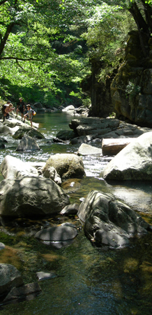
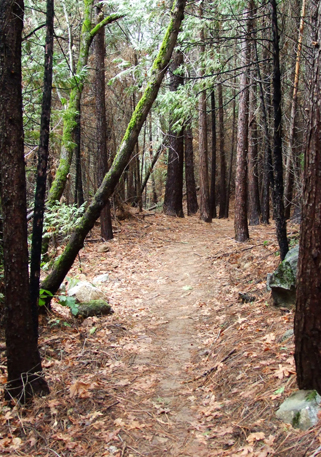
Deer Creek begins as a trickle in the Sierra Nevada foothills, high above Scotts Flat Reservoir at 4000' elevation. A ribbon of nature, it winds its way through pine forests and alpine meadows, forging canyons and shaping the landscape on its journey downhill. As it rushes through downtown Nevada City, it hosts spawning rainbow and brown trout. Downstream, little known but beautiful, Deer Creek Falls hurries the water towards Lake Wildwood, where residents enjoy swimming and boating. Below the lake, pine forest gives way to willow and oak, and the creek teems with beaver, river otter, eagles, and great blue herons. At 600' elevation and 34 miles from its source, Deer Creek joins the Yuba River, where it greets the native salmon spawn each fall.

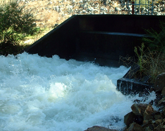
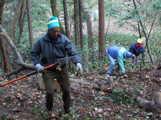
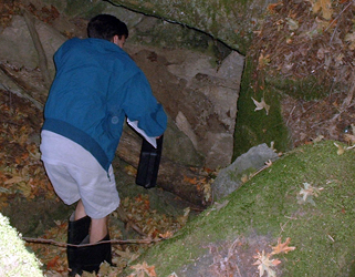
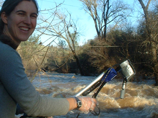
Deer Creek has been impacted by human use and abuse since the days of the Gold Rush. Prospectors turned over every section of the river, diverted its waters, logged its forests, and filled it with gravel and toxic mercury in their quest for riches. This legacy is still with us. Abandoned mines and mercury hotspots haunt the creek, and the native vegetation has been crowded out by invasive non-natives that create tinder-dry conditions in our hot summers. Over the past 150 years, trails to the creek have become overgrown, fish habitat has disappeared, and the remaining fish are tainted with mercury. And now, with the gold mining long ended, the creek faces new threats as our community experiences rapid growth. Land development, sewage disposal, agriculture, even car maintenance all require special care if we are to avoid further harm to the life of the creek.

Deer Creek watershed map

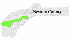
Location of the Deer Creek Watershed.

An integrated approach and understanding of how chemical, physical, and biological conditions interact and influence one another is essential for a thorough assessment of the ecological condition of the Deer Creek watershed. This principle guides all of our data-collection activities in the watershed, which at present include the following:

  • Monthly water quality monitoring at 17 sites. We measure nitrate, orthophosphate, dissolved oxygen, turbidity, pH, conductivity, water temperature, ambient air temperature, and bacteria (total coliform and E. coli).
  • Semi-annual gathering of macroinvertebrate data at 13 sites.
  • Annual physical habitat assessments at 13 sites.
  • Geomorphology surveys at 15 sites.
  • Monthly algae sampling at 6 sites during the summer and at 13 sites in June and October.
  • Fish sampling at 12 sites.
  • Stormwater sampling (at times of peak flows) to study mercury (Hg) transport.
  • Stream flow (discharge) at 8+ sites as part of our participation in the Sierra Water Trust project.

Our involvement in the Sierra Water Trust project has us monitoring and recording stream flow in Deer Creek. For more information on the data collection related to this project, as well as the project's other elements, follow the link in the Active Project box below.

Active Project

Sierra Water Trust Streamflow Project

Follow the link above to learn more!

For more information about participating in our monitoring programs, visit our Volunteer page.

Deer Creek Watershed

Deer Creek Monitoring Sites. Click map for larger image.

  • Data on water quality, macroinvertebrates, fish, algae, and physical habitat can be accessed from the Stream Science page.

Indicators of Stream Health

Move mouse over each image to learn more

  • To learn more about the various water quality parameters and their importance for stream health, visit the Stream Science page.

Human-caused impacts to the watershed are many and serious: three wastewater treatment plants discharge their effluent into the creek; development of homes, yards and streets along the creek contribute to erosion and discharge of household chemicals and fertilizers; grazing and agriculture contribute pollution and cause harm to riparian vegetation; dams and diversions interrupt the natural flow of the creek and degrade water quality and habitat complexity. Careful and regular monitoring allows us to identify these impacts. Minimizing them requires the adoption of "creek-friendly" practices by all: the casual visitor whether on foot, bike, horse or in a car, homeowners and developers; water management agencies; city, county, and state stakeholder agencies; farmers and ranchers; businesses; and everyone who lives, works, and plays in the watershed.

To help protect the Deer Creek watershed from further degradation, we do the following:

  • Help local governments develop "creek-friendly" construction practices throughout the county.
  • Work with Deer Creek property owners and city, county, state, and federal agencies to find science-based solutions to Deer Creek’s problems.

Lake Wildwood Reservoir release point, during a drawdown release. Periodically, the reservoir water level must be lowered to remove sediments and maintain reservoir storage capacity. FoDC/SSI has worked with Lake Wildwood for many years to manage the release so that impacts to Deer Creek are minimized. Photo by Thomas Spellman.

In the Sacramento River Basin Report Card (SRBRC), the Deer Creek watershed scored a 63/100 for hydrologic alteration, with unnaturally high summer flows reported as the most highly altered aspect of Deer Creek hydrology. Additionally, the Deer Creek watershed received some of the lowest scores in terms of aquatic barriers (67) and habitat fragmentation (5) in the SRBRC, suggesting impaired conditions that warrant future assessment and restoration efforts.

Deer Creek's health is important to the quality of life of the peope who live in the watershed. Hundreds of creeks in California have already been lost forever to development. Restoring Deer Creek offers a unique opportunity to work together to keep our homes and businesses in harmony with the wilderness. When our work succeeds, residents and visitors alike will be able to hike on trails by sparkling silver waterfalls, eat fish from pollution-free pools, and swim with their children in the riffles of a crystal clear stream.

To restore Deer Creek and its watershed, we have...

  • developed the Deer Creek Watershed Restoration Plan in collaboration with the Tsi-Akim Maidu Tribe to prioritize future restoration efforts.
  • restored native vegetation and fish habitat to Little Deer Creek in Pioneer Park.
  • developed a gravel augmentation plan for lower Deer Creek to improve salmon spawning habitat.
  • restored native vegetation to a floodplain restoration area with the help of a high school ecology class.

Many of our restoration efforts are currently dedicated to restoring spawning habitat for Deer Creek's native salmon and steelhead near the confluence with the Yuba River. To learn more about this project, follow the link in the Active Project box below.

Active Project

Salmon and Steelhead Habitat Restoration

Follow the link above to learn more!

For more information about participating in one of our restoration projects, visit our Volunteer page.

Restoration Day activities along Little Deer Creek. December 9, 2009. Photo by Matt Freitas.

FODC/SSI has conducted soil sampling for heavy metals at several abandoned mine sites adjacent to Deer Creek. An EPA Brownfields Community Wide Assessment of Nevada City-owned properties conducted by FODC/SSI was completed in 2009. The assessment indicated that the levels of heavy metals were elevated enough at two sites along Deer Creek to warrant cleanup to protect human health and the environment.

At the Stiles Mill site, located near the Pine Street bridge across Deer Creek from downtown Nevada City, soil samples from a mine waste stockpile along the creek indicated elevated arsenic and lead in most samples. Arsenic levels generally ranging from 60 to 200 mg/kg (ppm) and lead levels from 140 to 250 ppm were in excess of the typical regulatory cleanup goals of 22 ppm and 80 ppm, respectively.

At the Providence Mine site located approximately one mile downstream of downtown Nevada City, a steep slope of mine waste eroding into Deer Creek is also impacted by elevated arsenic and lead concentrations. Arsenic levels generally measured from 40 to 75 ppm and lead from 100 to 500 ppm. Much higher lead levels were detected in soil adjacent to part of a popular trail above the creek.

Based on the results of the Brownfields Assessment, EPA awarded three Brownfields Cleanup Grants to the City of Nevada City for the Stiles Mill and Providence Mine sites. Cleanup work coordinated by Sierra Streams began in 2011 and was completed in 2015.

To learn more about the clean-up projects at Providence Mine and Stiles Mill, follow the link in the Active Project box below.

Active Project

Brownfields Assessment and Clean-up

Follow the link above to learn more!

A volunteer collects samples for heavy metal analysis along Gold Run Creek in Nevada City. Photo by Marisha Finkler.

Protecting the health of the environment is important for all life in the watershed, including its human inhabitants. Threats to human health include the presence of toxic heavy metals that remain in the creek from the gold mining era, and bacterial contamination from fecal matter that especially impacts the lower watershed.

Our public-health related efforts include the following:

  • Working with Nevada County Department of Environmental Health to identify and remediate bacteria sources.
  • Studying the bacterial contamination problem in Squirrel Creek where it passes through Western Gateway Park in Penn Valley (see the Active Project below).
  • Surveying recreational users of the watershed to determine exposure to heavy metal contamination.
  • Collecting and analyzing stormwater samples to determine whether mercury is transported downstream over dams trapped in the algae-sediment mixture.
  • Providing our scientific data to the State to bring needed attention to the lower Deer Creek watershed to improve water quality and ecosystem health.

Gold mining left a lasting environmental legacy in the form of heavy metals such as lead, cadmium, and arsenic that were mined along with the gold and abandoned in vast piles of wasterock along the creek, where they remain to this day. The gold extraction process involved crushing the ore, leaving tailings containing highly contaminated dust that is easily breathed and continues to pose a serious threat to human health. Lead poisoning in children causes damage to the brain and nervous system, with ingestion of contaminated dust being the most common means by which lead enters the body. Long-term exposure to arsenic and cadmium causes several cancers, and there are also short-term health effects which are felt within a few days of exposure. Lead, cadmium, and arsenic have been found at very high levels in various areas in the Deer Creek watershed where people might be exposed to them.

Active Project

Community Health Impacts of Mining Exposure

Follow the link above to learn more!

Another toxin, mercury, was mined in the coastal ranges and introduced to the watershed in huge quantities for the purpose of amalgamating gold. Mercury is a powerful neurotoxin, especially harmful to the brain development of young children and fetuses. Deer Creek is thought to have some of the highest concentrations of mercury in the state. Brown trout in Little Deer Creek, a tributary of Deer Creek, have among the highest detected mercury concentrations in the Sierra. Much of the mercury in our streams is present in sediments; when these sediments are mobilized, mercury is transported and becomes much more likely to enter the food chain.

Active Project

Mercury Transport Study

Follow the link above to learn more!

Bacterial contamination from fecal matter is another serious concern, especially to young children who may be exposed in the course of swimming and playing in the creek. Our scientists have discovered a serious problem at the Squirrel Creek swimming hole in Western Gateway Park in Penn Valley, which is frequented by children and families drawn to the site by the wide shallow pool and nearby park amenities, including picnic tables, a playground, and playing fields. We have been studying this contamination problem since 2005 in an effort to find ways to make the creek a safe place to swim. Follow the link in the Active Project box below to learn more about this project.

Active Project

Squirrel Creek Bacterial Study

Follow the link above to learn more!

mercury sampling

Mercury sampling near Smartville.

What better way to explore Deer Creek's rich history and scenic beauty than to hike along the Deer Creek Tribute Trail? The Tribute Trail offers a path into the past while giving different perspectives on the present. The interpretive signs along the trail identify both native and non-native plants seen along the trail, describe floodplain function and restoration, explore the rich history of Chinese immigrants during the gold mining era, and pay tribute to the Nisenan who were the original human inhabitants of this watershed.

The multi-use trail offers a cultural and ecological greenway through Nevada City, California. The trail begins in historic downtown Nevada City and moves along scenic backroads and trails. Ponderosa Pine, Black Oak, and Live Oak create a peaceful and shaded pathway for people of all ages and abilities. Portions of the Tribute Trail are available for picnics, bicycling, hiking, swimming, fishing, and horseback riding. Come and walk a portion of the trail and then have lunch in downtown Nevada City, or challenge yourself to the full 8-mile trail.

The Deer Creek Tribute Trail was created with funding from the CA Natural Resources Agency California River Parkways—Proposition 50 grant program. Friends of Deer Creek/Sierra Streams worked with a broad consortium of project partners to make the trail a reality: The Sierra Fund, American Rivers, Nevada County Land Trust, the City of Nevada City, Nevada County, the Nisenan Tribe, the Tsi-Akim Maidu, the Bureau of Land Management, Greater Champion Neighborhood Association, the Chinese Quarter Society, and Save Our Historic Canals.

Tribute Trail west of Nevada City, off Old Downievile Hwy and Champion Mine Rd. Photo by Matt Freitas.

Tribute trail map

Click this image to see a full-size map of the Tribute Trail.

  • TRAIL ACCESS
    From the Nimrod St. trailhead across from Pioneer Park, follow the trail along Little Deer Creek to the Stonehouse parking lot. Cross the parking lot and Sacramento Street, heading up Broad Street. Turn right onto Union Street and then left on Commercial Street to the Chinese Monument before taking York Street south toward the Miners Foundry. Walk on Bridge Street along the west side of the Miners Foundry and then turn right on Factory Street before you get to the end of the Miners Foundry building (Do not continue on Bridge Street!) Walk west on narrow, winding Factory Street, which becomes Wyoming Street, and then continue left onto Old Downieville Highway. Bear left on Champion Mine Road after walking approximately two thirds of a mile from the Miners Foundry. Shortly after turning on Champion Mine Road, signs with the Tribute Trail logo will direct you along the rest of the trail, which follows the Newtown Ditch and heads down to Deer Creek. Portions of the trail along the Deer Creek service road and the Newtown Canal, as well as portions of the trail through Nevada City (from the Stonehouse parking lot to Champion Road), meet California State Park accessible trail standards.